760-376-3745
 Help Me Choose a Rafting Trip
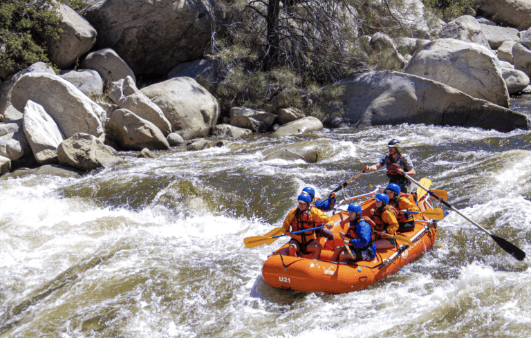
The North Fork of the Kern River aka the Upper Kern is born on the steep slopes of the lower 48’s tallest peak, 14,500ft Mount Whitney. Rivers love to meander, but the Kern River follows a unique North-South fault line (the Kern Trench) which steers the river in a near perfect line 80 miles south to Kernville. The remarkable beauty, clean water, exceptional wildlife and ample opportunity for recreation gave the Kern River its designation as a Wild and Scenic River in 1987. As all free flowing Sierra Mountain rivers, the Kern is dependent on snow in the winter for water in the spring and summer. Through the lens of whitewater recreation, a good snowpack on Mount Whitney can provide us with enough water to raft and kayak the Upper Kern from March to August. High water typically comes on June 1st, give or take two weeks on either side. When the snowpack is great, the Upper Kern has some of the best whitewater rafting and kayaking opportunities in the United States. Sections like the multi-day wilderness Class IV-V Forks of the Kern, Class IV day sections like Limestone, Ant Canyon, Chamise, Cables, the famous class V Thunder Run, and the wildly popular Class II-III Lickety section. When the snowpack is weak, or when we move later in the summer, the Upper Kern becomes too low to raft. At this point tubing becomes a great alternative way to experience the cool, clean, mountain water.
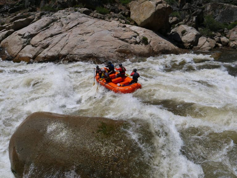
Below Kernville, the Kern River flows into the reservoir Lake Isabella. The dam was constructed in 1953 to provide consistent irrigation for the vast network of farms in Bakersfield and the central valley. The Lower Kern coming out of Lake Isabella provides another 25 miles of navigable whitewater. The water released from the dam is lined up with the irrigation needs of the farmers, so we tend to get more consistent water later in the season on the Lower Kern. In simple terms, the free flowing Upper Kern will always run out of water before the dam controlled Lower Kern. In low water years, or later in the summer, the Lower Kern provides enough water to recreate in both a rafts and kayaks. The whitewater on the Lower Kern is broken down into two main sections; the Picto and the Gusto. The Picto is a 10 mile class II-III section that begins at Keyesville, 100 yards downstream of the dam. The Gusto is a class IV section that begins at Miracle Hot-springs and continues downstream for another 12 miles. The Picto is a little more scenic, splashy, and longer than our Lickety run in the town of Kernville. The Gusto section is very comparable to the high quality Class IV sections on the Upper Kern.